Biddeford Pool's Parking Review Measured the Road and Found It Wider Than It Looks
November 12, 2026
November 12, 2026
When Biddeford city councilors walked Lester B. Orcutt Boulevard in August, a wedding was underway at St. Brendan's. Traffic Committee chair Roger Beaupre later said the timing gave the group "a very good opportunity to see what it's like when there's a full-scale event going on," with people parked along the boulevard and on the side streets. At a later meeting, Chris Flynn, president of the Biddeford Pool Improvement Association, said a wedding of that size "happens a couple times a summer" and is not the usual summer day.
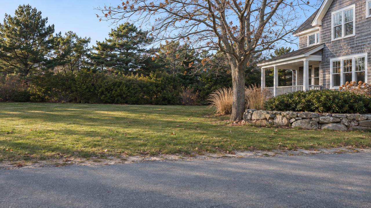
That disagreement over what a normal day on the boulevard looks like has driven the whole review. The city has spent nearly two years studying the road from Mile Stretch Road out to East Point Audubon Sanctuary. The committee chair has now proposed leaving the parking as it is. If the boulevard looks the same next summer, the lasting result will be a property survey. It showed that the public right-of-way is much wider than the 22 feet of pavement people drive on.
The review began with a narrow fix. In January 2025, residents speaking for the BPIA told the Traffic Committee about conflicts among cars, pedestrians, cyclists and roadside parking on the boulevard. In March 2025 the committee approved a 90-day trial no-parking zone near the East Point entrance, and Public Works put it in place from June through September 2025. The committee recommended making it permanent in October 2025, and the City Council adopted it in November after two readings.
The rule is now in Biddeford's city code. It bans parking on the boulevard's "even-numbered side, beginning at a point with the southwesterly corner of the intersection with Ocean Avenue, thence westerly for a distance of 130 feet." Flynn later said the BPIA considered that the dangerous stretch, where sight lines are poor and the road narrows.
The fix was small, but the council did not stop there. During the November 2025 debate, councilors worried that removing roadside spaces could limit public access or push parking elsewhere in the neighborhood. They directed staff to map the full public right-of-way.
In March 2026 the Traffic Committee held an informational meeting on a boundary survey of the boulevard between Ocean Avenue and First Street. The city notified 29 nearby property owners by mail and followed up with an online meeting. Dow & Coulombe, a Saco land survey firm, completed the work in April.
The survey found a public right-of-way "substantially wider than the existing traveled pavement." Within it the surveyors mapped vegetation, landscaping, fencing, stones and other features. In other words, many of the hedges and rocks along the boulevard sit on public land. City Engineer Craig Chekan presented the findings to the council in June.
Once the extra width was on a map, the city could plan with it.
At the August 11 council workshop, Public Works presented a preliminary concept for off-pavement parking and a five-foot pedestrian route. Beaupre later stressed that it was meant to start discussion and "was not presented as a final design." The workshop map showed 52 proposed parking spaces, 7 existing spaces, 2 existing Audubon spaces and a five-foot flush pathway. In meeting discussion, the total of 61 was often called "61 spaces."
The Biddeford Gazette reported that an overflow crowd filled the workshop and that most speakers opposed substantive changes. Mayor LaFountain told the room, "This is just a concept discussion," and said the council would keep studying the issue. Ward Five Councilor David Kurtz called the situation "a solution in search of a problem." Councilor Patricia Boston, who represents the coastal neighborhoods, said the council first had to decide which problem it was trying to solve.
On September 15, the council sent the matter to the Traffic Committee and asked for one recommendation by November 17. The council's charge named goals that pull against each other:
The third and fifth goals both depend on the strip the survey mapped.
The BPIA hired Bowman Consulting Group to study the boulevard, Ocean Avenue and nearby streets from August 5 to 9, 2026. The association's cover letter to the council, filed in the Traffic Committee meeting packet, lists the main findings.
| Measure | Bowman finding, August 2026 | Compared with |
|---|---|---|
| Peak parked cars, Ninth Street to Ocean Avenue | Maximum of 27 and minimum of 14 on Saturday, August 8 | 52 proposed spaces plus 9 existing on the city map |
| Reported crashes | None, 2021 through 2025 | Safety was the council's stated reason for the review |
| Speeds on the boulevard and Ocean Avenue | 85th-percentile speeds 16% to 28% above the posted limit, in both directions | Bowman said widening would encourage higher speeds |
| Road width under the proposal | About 50 feet | About 22 feet today |
The study also found that 63% of parked cars had out-of-state plates. The BPIA letter quotes Bowman's conclusion:
"Based on the safety data reviewed and the traffic and parking data collected as part of this study, the proposed parking expansion is not supported by existing parking demand and could introduce roadway, environmental, and neighborhood impacts without a demonstrated transportation need."
Using all that public width for parking would mean paving it from one edge to the other. That would take the boulevard from about 22 feet to about 50, according to Bowman. At the September 22 committee meeting, Flynn added a concern about the tree canopy near Ocean Avenue. He noted that the initial proposal would remove only three trees, but said disturbing the ground could harm other mature trees and raise runoff and erosion concerns. The committee tabled the item 5 to 0 that night.
The survey also changed what was happening along the shoulder. On the site walk, councilors noted rocks and other features placed in or next to the right-of-way near Ocean Avenue. In September, Flynn told the committee that neighbors had been clearing rocks and shrubs from the road edge, on the boulevard and on some side streets. He said the work had created something close to a walkway along the north side of the boulevard, a place where pedestrians can step off the pavement when an emergency vehicle or a speeding car comes through.
That is close to the pedestrian space the city's concept called for, made without paving. Flynn also said that if more access is needed, giving Biddeford residents priority parking at the end of the street would make more sense than adding off-street spaces. On its own site, the BPIA says Police Chief Joanne Fisk is forming a Parking and Traffic Safety committee that will include association board members.
At the October 27 Traffic Committee meeting, Beaupre asked whether any member had a proposal. None was offered. He then said the committee had "not identified a real problem at that location" and that he would write the council a memo for on or before November 17. The memo would say the trial no-parking zone had achieved its goal and that no further changes to parking on the boulevard were recommended. "In other words, status quo," he said. No member commented, and he closed the item.
Any change would also take time. Beaupre told the committee in September that the earliest the council could take up a recommendation was December. A change to the traffic ordinance needs two readings and takes effect 30 days after the second. Meeting materials are posted on the city's CivicClerk portal.
For a walk out to the point this winter, the rules are the same as last summer. Maine Audubon's East Point page says shoulder parking is very limited, with room for about 6 cars. The trails are open sunrise to sunset and are foot traffic only. The 130-foot no-parking stretch near Ocean Avenue still applies. Down at Gil Boucher Park, the state's coastal public access guide lists a seasonal parking permit from City Hall between June 15 and Labor Day, and no overnight parking. This post is general information about local rules, not legal advice. Check posted signs and the city code for your own situation.
Owning near Lester B. Orcutt Boulevard means following both the parking question and the boundary survey. If you want to talk through what this review means for a home along the boulevard or its side streets, Adrienne Robinson and Elaine Prendergast are glad to sit down with you. Request a complimentary market consultation, and we will go through it with you street by street.
Get assistance in determining current property value, crafting a competitive offer, writing and negotiating a contract, and much more. Contact us today.